Dataset Description
Oil Spill Detection Dataset contains jpg images extracted from satellite Synthetic Aperture Radar (SAR) data depicting oil spills and other relevant instances, as well as their corresponding ground truth masks. Initial SAR data were collected from the European Space Agency (ESA) database, the Copernicus Open Access Hub acquired via the Sentinel-1 European Satellite missions. The required geographic coordinates and time of the confirmed oil spills were provided by the European Maritime Safety Agency (EMSA) based on the CleanSeaNet service records, covering a period from 28/09/2015 up to 31/10/2017.
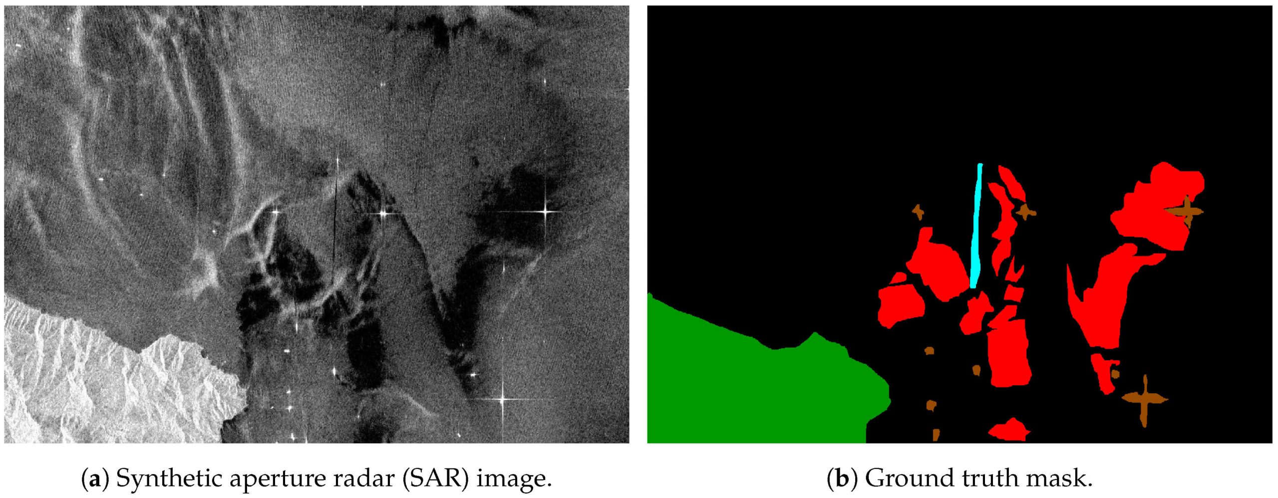
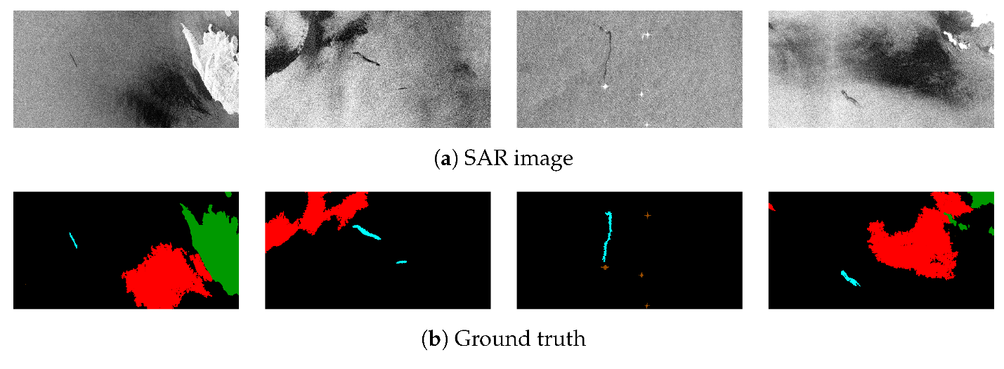
The developed dataset (~400MB) contains around 1000 images for training and 110 images for testing, depicting instances of 5 classes, namely oil spill, look-alike, land, ship and sea areas. Additional details concerning the applied preprocessing, class distribution, etc. can be found in our work entitled “Oil spill identification from satellite images using deep neural networks”. Oil Spill Detection Dataset is available to the research community under specific terms of use.
In order to provide you with the dataset you have to follow the following steps:
- Read the datasets Terms of Use which are accompanied, among others, the sharing terms with other individuals.
- Prepare a title and a short description (abstract) for your project that will benefit.
- Send us an email (based on the indicated template) using your institution’s email. In order to grant you access to the data, we need it to contain the template statements.
- In the case of undergraduate and postgraduate students, you should ask your supervisor to complete the above form, and mention you as a supervisee. We cannot collaborate with researchers who do not have a full-time academic contract.
Before you apply:
- Be as specific as possible about your access request.
- If you intend to request for an alternative collaboration agreement, please provide explanations about why you consider your request as appropriate.
- The dataset’s Terms of Use are serious. Please go through the entire document carefully. If you do not comply, it will be requested from you to delete all the dataset, and may ask editorial offices to retract any publications from the period that your request was active. In extreme cases, we will contact directly the university department that the corresponding work is executed.
Contact
Marios Krestenitis: mikrestenitis@iti.gr
Konstantinos Ioannidis: kioannid@iti.gr (CCed)
Downloads: 166
Visualizations
Publications
In case you use the Oil Spill Detection Dataset or our work is useful to your research activity, please cite the following publications:
- Krestenitis, M., Orfanidis, G., Ioannidis, K., Avgerinakis, K., Vrochidis, S., & Kompatsiaris, I. (2019). Oil spill identification from satellite images using deep neural networks. Remote Sensing, 11(15), 1762.
- Krestenitis, M., Orfanidis, G., Ioannidis, K., Avgerinakis, K., Vrochidis, S., & Kompatsiaris, I. (2019, January). Early Identification of Oil Spills in Satellite Images Using Deep CNNs. In International Conference on Multimedia Modeling (pp. 424-435). Springer, Cham.